April, 8, 2021

Joint project by IT teams of SriLankan Airlines & AASL
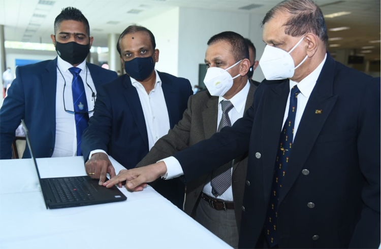
Google Indoor Maps was launched at Colombo’s Bandaranaike International Airport (BIA) today, becoming the first indoor facility to enable this feature in Sri Lanka. SriLankan Airlines and Airport & Aviation Services (Sri Lanka) (Private) Limited teamed up in a remarkable joint project that resulted in BIA becoming the first venue in Sri Lanka to be enabled on Google Indoor Maps, accessible on smart phones and tabs on both Apple and Android devices. Google Indoor Maps puts yet another resource in the hands of passengers and visitors for finding out many possibilities available to them before they start their journey or arrive at the airport.
Passengers and visitors to BIA can access detailed digital floor plans of the Departure, Transit and Arrival Terminals with just a few easy swipes on smart phones or tabs. Google Indoor Maps can be accessed via the desktop version of Google Maps as well as from the Google Maps Mobile App for Android and Apple iOS devices. SriLankan Airlines, as the authorised ground handler of BIA, and AASL as the airport operator took on this project in the firm belief that this would be a fresh experience for Passengers.
Initiatives such as these are furthering the digital and IT roadmap of the country in conforming with the vision of HE the President, under the guidance of the Minister of Tourism, State Minister of Aviation and Export Zones Development and the leadership of the Major General (Rtd.) G A Chandrasiri, Chairman of AASL and Ashok Pathirage Chairman of SriLankan Airlines.
“Using indoor maps, users will find it easy to locate building directories within the airport enabling indoor wayfinding to greatly improve passenger experience. This feature helps passengers get to the appropriate gate, terminal, baggage claim, or ticketing counter on time by providing landmark-based navigation”, stated Ashok Pathirage Chairman of SriLankan Airlines.
SriLankan Airlines CEO Vipula Gunatilleka said, “ For both experienced and novice travellers it is very important to have airport navigation at the palm of their hand. The possibilities with Google Indoor Maps extend beyond indoor wayfinding. By implementing and interfacing to an indoor positioning technology, you can engage with travellers whilst they are at the airport.”
Google Maps is a world-renowned online mapping service and is a primarily wayfinding tool with millions of users around the world. The indoor maps at BIA will feature gates and check-in counters, amenities, and retail outlets across multiple levels to make it easier for passengers to navigate through the terminal. Visitors will benefit from the intuitive layout and functionality, such as zooming for granularity and search functionality to spend less time searching for building directories and more time discovering new points of interest making their travel through BIA a seamless experience. Further, this facility will enable virtual visibility of B2B establishments located within the airport to optimize their business processes and deliver better services to end-customers and partners.
Major General (Rtd.) G A Chandrasiri Chairman of AASL said, “We hope the new Indoor Google Maps can help passengers more seamlessly explore the airport with the complex indoor locations, whether it’s their first time visiting the airport or simply trying to find the easiest and quickest way to navigate within the premises. Google Indoor Maps not only enables wayfinding to help passengers navigate, but it can also help improve safety, situational awareness, and facilities management.”
Google Indoor Maps is like a conventional indoor directory listing as users can browse through the information available on Google Indoor Maps to see places around them and to find their own way inside the airport. Detailed digital floor plans will automatically appear as users zoom in and out on Google Maps to switch between Google Indoor Maps and the usual Google Maps for outdoors. Approximately 10,000 venues in 62 countries around the world are currently available on Google Indoor Maps, with Sri Lanka becoming the 63rd country with this implementation.
The familiar location identifier ‘Blue Dot’ icon can help indicate approximate location in order to help users find their way more easily. In addition, this would help passengers to become familiar with the airport terminal premises before they arrive at the airport as this provides insights to help travellers make informed decisions.
Video Story